|

 |
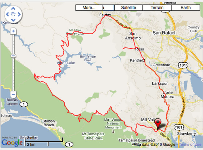
Friday Route: Alpine Dam Loop
This whole route is a paved ride and absolutely fantastic, truly one of the best rides anywhere in the world. Though it's only 31 miles, it took me almost three hours and will take some people four hours. Total elevation gain is 3500 feet. |
 |
|
|
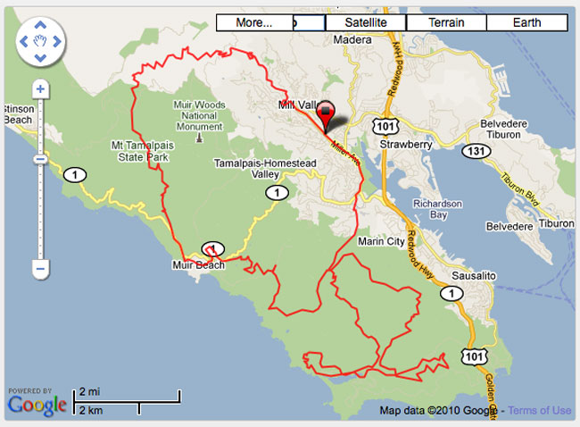
Saturday Route: Mt. Tam, Marin Headlands, and Beyond
This is the main route we'll ride during the July 23-25 Rough Riders Rally; specifically, this is the route for Saturday, July 24. You'll note that it is "only" 36.5 miles, however these are 36 and a half of the most beautiful miles one could ever ride, plus it's also an extremely challenging route. Note the total elevation gain of 5,764 feet. Most century cycling events have less climbing than that! The route features single track, double track, fire road, gravel road, abandoned paved road, and newly paved road. Some consider this "mountain bike territory," but this route is 99% rideable by an accomplished Rough Rider on a road bike with 32mm cyclocross tyres (or on a cyclocross bike), and perhaps 90-95% rideable on a road bike with 28mm road tyres. |
 |
|
|
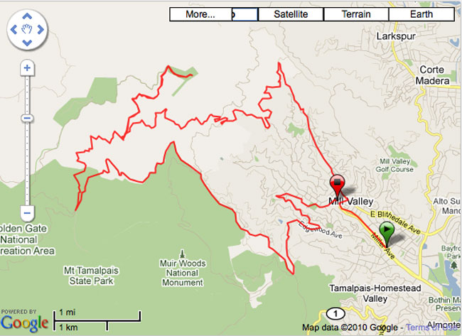
Sunday Route: Railroad Grade to West Peak of Mt. Tam and Back
This is the classic ride up Railroad Grade from Mill Valley to the top of Mt. Tam, also known as East Peak. The return is mainly via paved road, after returning to the West Point Inn on Railroad Grade. This return utilizes a few miles of dirt from the Rally's Saturday ride, and some paved miles on the way back into Mill Valley from the Rally's Friday ride, however this takes a "locals only" route back to The Depot at the end of the ride. The final "occasion" of the Rough Riders Rally will be social time at The Depot in downtown Mill Valley. Total distance is 20 miles with 2800 feet of elevation gain. |
 |
|
|
BONUS: Route from Acqua Hotel to Tam Bikes
It's just 1.7 miles from our host hotel to the start / finish of each of the three rides. Acqua Hotel is not only perfectly located, it's also a lovely hotel with a fantastic breakfast buffet. Though it's located right off the 101, it's absolutely quiet. The view of Mt. Tam is to die for, too! |